|
|
 |
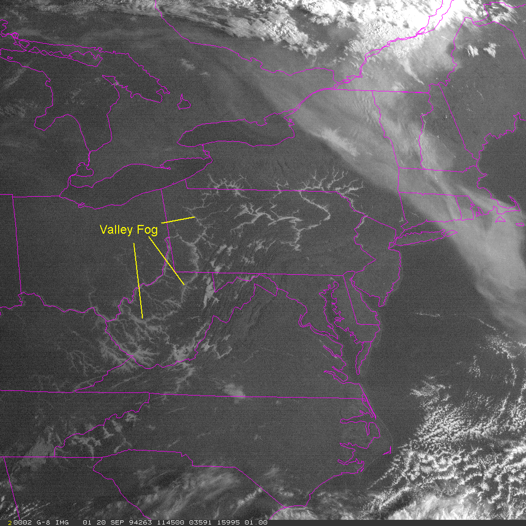
Lesson 9: Background: Valley Fog
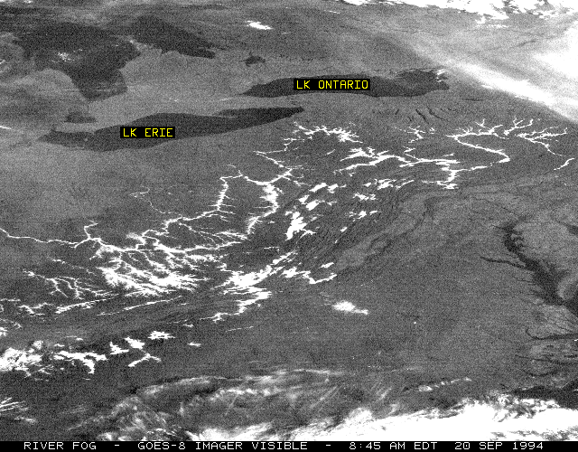
Radiation fogs are frequent in the fall in river valleys and small depressions. The cold air sinks to the bottom of the valley providing the cool air, while rivers and streams provide the water vapor needed to increase the relative humidity via evaporation. These fogs are often called valley fogs. Valley fogs are easily recognized in visible satellite images as they follow the contours of river valleys.
There are a couple of guidelines for forecasting a radiation fog. If the dew point temperature is approximately 5°C below the air temperature at sunset, and if the winds are predicted to be less than 5 knots, there is a good chance that a radiation fog will form during the night.
Return to Lesson 9
Return to Satellite Meteorology Main Page
|

