|
 |
|
|
|
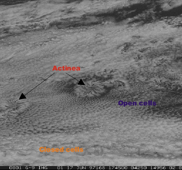
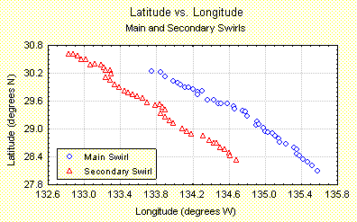
Lesson 9: Background: Fog and StratusActinae are radial arms of cloudiness between the regions of open and closed cells (Hauz, 169). Actinae were observing over the Pacific Ocean using Geostationary Observational Environmental Satellite (GOES) at approximately 29°N latitude and 134°W longitude, on 17 June 1997. The cellular patterns associated with actinae tend to occur over cool ocean currents while west of continents but have also been observed to occur over warm currents (Hauz, 1993). The following analysis was conducted by Mr. L. Lunch and Ms. K. Morgan, high school students who completed this project during their involvement with the NASA SHARP PLUS Program in 1997. For purposes of this study, the larger structure will be referred to as the main system, the smaller, as the secondary system.
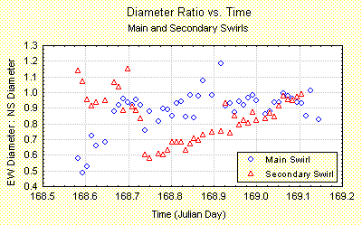
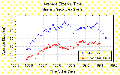
Time series of the images were analyzed to observe progressions, transformations, and developments of the actinae, and the environment. To remove the translation of the system (The actinae maintained constant southwesterly motion at a speed typically ranging between 16 and 40 km/hour. ), this analysis was centered on the cloud free region of the convective system.
The average size of the actinae, determined by averaging the NS and EW diameters |