|
|
 |
Lesson 8: Background
The GOES-8 sounder retrieves profiles of temperature and moisture for clear
or partly clear fields of view. These retrievals are further processed to
produce a derived meteorological
product (e.g. total precipitable water). Images of these derived products
are generated by combining the sounding product with the 11 um window
radiance observed in the cloud-contaminated fields of view. The sounding value
is allocated to the first half of the dynamic range of the grey scale used for
image presentation, whereas the 11um cloud radiance is allocated to the second
half of the grey scale range. The sounding portion of the grey scale is then
color-enhanced in order to distinguish the sounding values from the cloud
features.
Several of the GOES-8 sounder derived products are:
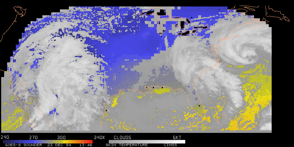
- The land-sea temperature is derived with each
retrieval.
The algorithm combines moisture corrected window channel temperatures with
NMC forecast model fields spatially and temporally
interpolated to the
retrieval locations, hourly surface observations, and sea surface temperature
values from AVHRR.
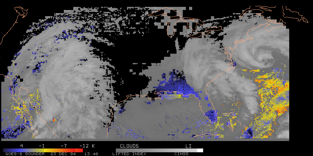
- The lifted index, an estimate of atmospheric stability,
is derived for each retrieval. It
represents the buoyancy that an air parcel would experience if mechanically lifted from a
mixed boundary layer to the 500-mb level . The lifted index expresses the difference in
temperature between the ambient 500-mb temperature and the temperature of the lifted
boundary-layer parcel. Negative values (parcels warmer than the environment)
represent positive buoyancy, with large negative values indicating the potential for
severe storms; positive values denote atmospheric stability. The lifted
index is derived from the 500-mb temperature as well as a
mean pressure, temperature, and moisture for the boundary layer (all are
all available from the retrieved profile).
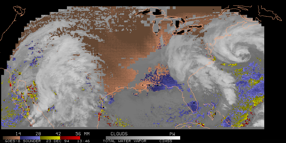
- The total column precipitable water vapor is obtained by
integrating the retrieved
moisture profile. Using the radiance measurements in the longwave split windows, the
shortwave window, and the 6.5, 7.0, and 7.4 um water vapor bands, the derived
product imagery is
formed from pixel-by-pixel retrievals of atmospheric temperature and moisture profiles
wherever the atmosphere is at least quasi-clear.
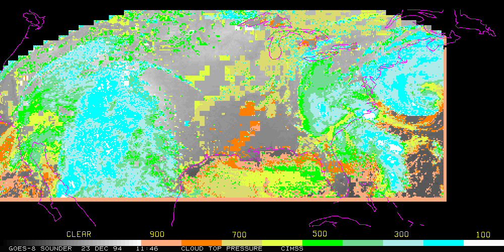
- The GOES-8 sounder is also providing an hourly cloud product
to supplement the ASOS.
This is required by the NWS introduction of the ASOS nationwide. ASOS is designed to
support weather forecast activities and aviation operations. ASOS uses automated
equipment to provide near-continuous observations of surface weather data including
cloud height and amount that are currently obtained by NWS and Federal Aviation
Administration observers. The cloud information from the ASOS equipment is limited to
altitudes below 12000 ft, and GOES-8 provides supplemental information about cloud
cover above 12000 ft at each ASOS site. The combined ASOS/satellite (ASOS/SAT)
system depicts cloud conditions at all levels to 25000 ft. Because observations are
required every hour, the satellite cloud product can be derived only from the
geostationary spacecraft data. The satellite cloud information is derived using sounder
data with the CO2 slicing technique, which calculates both cloud-top pressure and
effective cloud amount from radiative transfer principles. It also reliably separates
transmissive clouds that are partially transparent to terrestrial radiation from opaque
clouds in the statistics of cloud cover. For a given ground observation site, the algorithm
uses radiation measurements from an area of roughly 50 km x 50 km centered on the site.
More from the CIMSS page on GOES Sounder, where much of this information on this series was obtained.
Return to Satellite Meteorology Main Page
AOS Main Page
Current Madison Weather
CIMSS GOES Gallery
|

