|
|
 |
Determining Atmospheric Winds using Satellite Observations
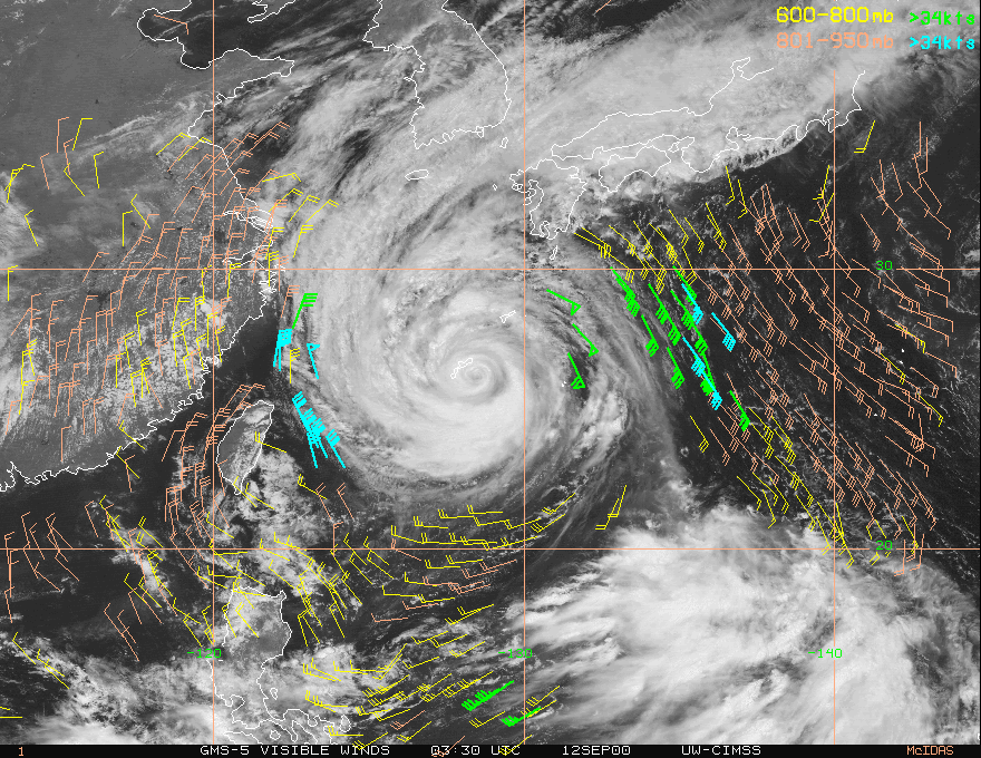
A time sequence of satellite images are routinely used to determine atmospheric wind speed by tracking the movements of winds. While the concept is simple, the proceedure is rather complex. Here's an example of cloud tracked winds around Typhoon Saomai from GMS-5 on 9/12/2000.  Here is a link to cloud tracked winds for hurricanse in real-time (CIMSS hurricane page). Here is a link to cloud tracked winds for hurricanse in real-time (CIMSS hurricane page).
Continue with tracking clouds using weather satellites.
Return to Lesson 7
Return to Satellite Meteorology Main Page
AOS Main Page
Current Madison Weather
CIMSS GOES Gallery
|


