|
 |
|
|
|
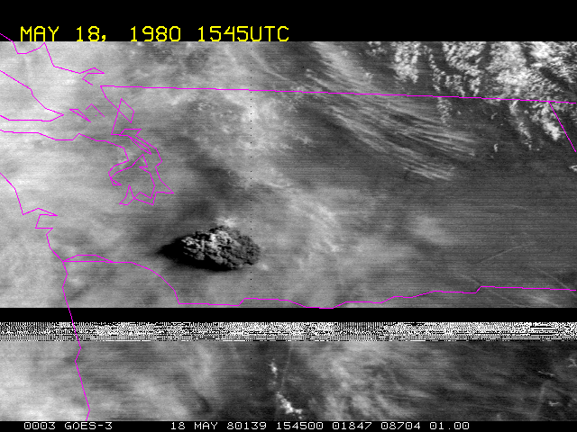
Lesson 6: VolcanoesGOES 3 view of Mt. St. Helens eruption on May 18, 1980. This is an early GOES instrument and the data quality is sometimes poor.
If you are not sure where the ash cloud is or the bad data, you can test yourself with this Java Applet. The geostationary perspective provides frequent viewing, which permits analyzing a time sequence of an eruption. Here is an animation of the Mt. St. Helens eruption using observations from the GOES-3 satellite. Mt. St. Helens (Location: 46.2N, 122.2W Elevation: 8,363 feet (2,549 m))erupted on 18 May 1980 sent thousands of tons of ash into the atmosphere.
Return to Satellite Meteorology Main Page
|