|
 |
|
|
|
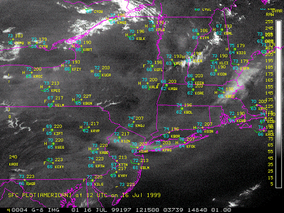
Lesson 6: Pollution and Haze Case StudyOn 16 July 1999 a major pollution event occurred in New England. A layer of low-level haze extended from central New York eastward over the Atlantic Ocean. The pollution was analyzed to determine the spatial extent and temporal change of the pollution event is seen in GOES-8 visible imagery.vIn the early morning haze was reported in eastern Long Island and southeastern Delaware as well as in western New York and throughout Pennsylvania (See Figure below). The winds were light and variable causing the pollution to remain in the region. A valley fog was reported in central New York and western Pennsylvania.
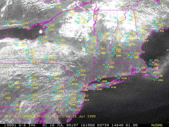
By the early afternoon popcorn cumulus has developed over western New York and Pennsylvania (See Figure below). The cumulus formations in New York are strongly related to topography. The river valleys are free from cumulus, but haze is present and the mountainous regions have both cumulus clouds and haze. The absence of cumulus clouds in the valleys leads to higher temperatures there than in the mountainous regions. The winds continue to be light and varied causing the haze to persist throughout New England.
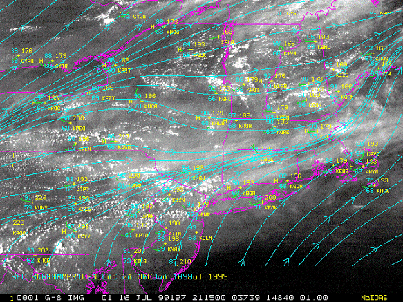
In the late afternoon a convergent zone set up across Delaware and southern Massachusetts (See figure below). This convergence zone formed a thicker band of haze that stretched along the zone and over the Atlantic Ocean. The haze in central Pennsylvania had been advected to the east along this convergent zone, while the haze in New York remains.
|