 |
 |
|
|
|
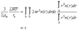
Lesson 3: BackgroundRelating cloud optical and physical parameters Single scattering parameters are not particularly sensitive to the exact drop size distribution, but are controlled primarily by the total surface area of drops within the cloud. The radius associated with the average surface area of the drops is called the effective radius re: Imagine a cloud of thickness z made up of drops following a size distribution n(r). We can compute the optical thickness, t ,of this cloud by integrating the extinction coefficient, to find
where we can make the last approximation in the visible, where cloud drops have large size parameters. How can this be related to the cloud physical properties? The liquid water content of this cloud is the sum of the water mass in each drop
and the liquid water path is the liquid water content integrated through the depth of the cloud
We multiply by 3/2rw and use the definition of effective radius re:
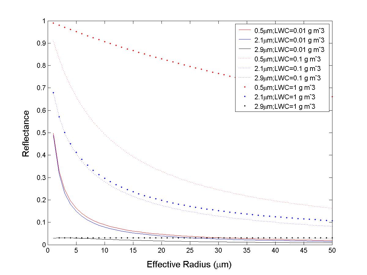
The last relationship is exact if n(r) is constant with height; the approximation holds to good accuracy for most distributions, and is very useful. Here's a useful figure for interpreting cloud reflectance as a function of cloud properties and wavelengths. |