|
 |
|
|
|
Lesson 16: Sea Sediments
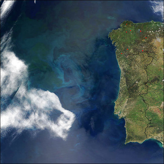
A large phytoplankton bloom off of the coast of Portugal can be seen in this true-color image taken on April 23, 2002, by the Moderate-resolution Imaging Spectroradiometer (MODIS) aboard NASA’s Terra satellite. The bloom is roughly half the size of Portugal and forms a bluish-green cloud in the water. The red spots in northwest Spain denote what are likely small agricultural fires. (http://earthobservatory.nasa.gov/Newsroom/NewImages/images_topic.php3?img_id=9258&topic=oceans) When Hurricane Michelle moved through the Caribbean in early November, it naturally stirred up the water. Its effect is particularly dramatic on shallow water around the Bahamas. Turbidity caused by the hurricane’s passage is seen in the MODIS image from November 6, 2001 in comparison to a similar image from October 2001. The MODIS image from November 6 shows high levels of turbidity in the Bahama Banks region following the passage of Hurricane Michelle. This true color image is paired with one from October 5 showing the normal clarity of the waters. Return to Satellite Meteorology Main Page
|