 |
 |
|
|
|
Lesson 16: Sea Surface TemperatureSea Surface Temperature
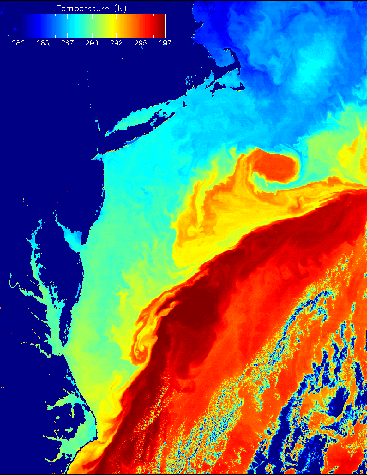
Oceanography is the study of the oceans and is essential to an understanding of weather and climate. The The rate of heat and moisture transfer depends on the temperature difference between the air and the water, as well as the strength of the winds. Warm sea surface temperatures (SSTs) and strong winds are favorable for large heat exchanges between the ocean and atmosphere. Sea surface temperature (SST) is another surface property we are interested in from a meteorological perspective. An IR window in the atmosphere for sensing surface temperature is the 10-12 micron region where absorption by water vapor is weak. Most of the radiation in this band is emitted by the surface and transmitted through the atmosphere. In a warm moist atmosphere the difference between the SST and the brightness temperature at 11 micron can approach 10°C. This difference is often corrected for by making observations at more than one wavelength, such as 11, 12, 3.7 and 8.5 micron. Differences between these channels represent the total amount of water vapor in the column. For example, the 12 micron channel has more absorption and therefore the difference BT11-BT12 is positive; the greater this difference the larger the water vapor loading of the atmosphere. Observations at these wavelengths are used daily to derive SST. The SST from satellite observations is typically determined from a regression derived empirically using observations from drifting buoys. SST's are often derived from polar orbiting satellits. The level of detail in SST structure is provided by this MODIS image. Seasonal Changes in GOES-8 Imager-Derived Sea Surface Temperature |
|
|
|
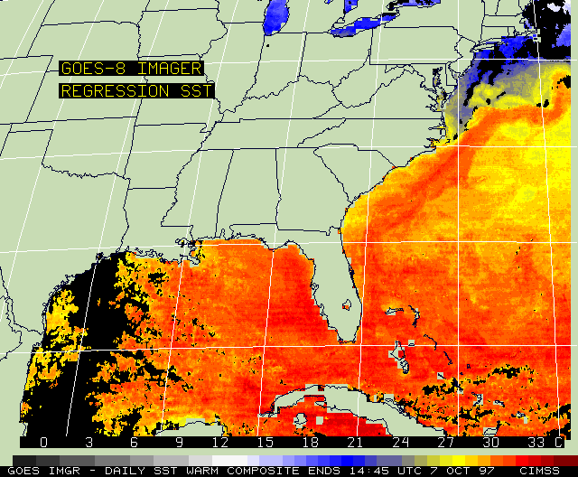
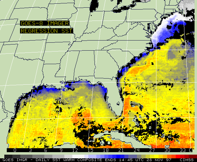
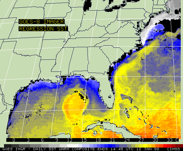
| 07 October 1997 | 28 November 1997 | 12 January 1998 |
The typical seasonal change that occurs in the sea surface temperature (SST) fields may be seen by viewing daily GOES-8 imager-derived SST composite image samples from 07 October 1997, 28 November 1997, and 12 January 1998. In October, warm waters (about 30 C) dominated the Gulf of Mexico and the region surrounding the West Indies; the Gulf Stream meandered past the coast of the Carolinas and extended out into the Atlantic Ocean near 37 N latitude. Cool water (near 20 C) marked the Great Lakes as well as the Atlantic Ocean south of New England.
By November, overall cooling was evident. Cool continental shelf water was seen along the northern Gulf coast and Southeast U.S. coast. Persistent cloudiness obscured most of the northern Great Lakes and compromised better delineation of the Gulf Stream. The character of the warm Loop Current in the east central Gulf of Mexico (25 N latitude, 86 W longitude) had started to emerge.
By January, continued overall cooling remained substantial. Strong gradients dramatically showed ocean features such as the Gulf Stream and Loop Current (even lending continuity to the flow of warm water (near 25 C) from the Caribbean through the Yucatan Channel, by the Loop Current, through the Florida Straits, past the east coast of Florida, and heading northeast into the Gulf Stream).
Realtime GOES-8 imager-derived SST products are available at CIMSS
Return to Satellite Meteorology Main Page
AOS Main Page
CIMSS GOES Gallery