Lesson 1
Meteorological Satellite Orbits
Lesson 2
Review of Radiative Transfer
Lesson 3
Visible Image Interpretation
Lesson 4
Infrared Image Interpretation
Lesson 5
Multispectral Image Interpretation
Lesson 6
Fires & Aerosols
Lesson 7
Winds
Lesson 8
Sounders
Lesson 9
Fog and Stratus
Lesson 10
Thunderstorm
Lesson 11
Energy Budget
Lesson 12
Hurricanes
Lesson 13
Global Circulation
Lesson 14
Synoptic Scale
Lesson 15
Local Circulation
Lesson 16
Satellite Oceanography
Lesson 17
Precipitation

Lesson 15: Flow around islands

island lee lines

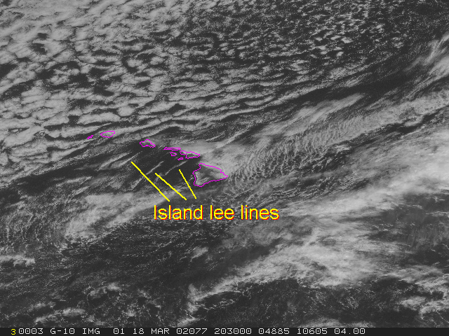
On 18 March 2002 island lee lines were observed around Hawaii in the visible 1km GOES-10 images. As wind flows around an island the air converges on the lee side, forming a line downwind. Also notice the clouds that form on the upwind side of the mountain islands due to upslope flow.


Return to Lesson 15

Return to Satellite Meteorology Main Page