|
|
 |
Lesson 14: Background
Surface Pressures Estimation from Synoptic Cloud Patterns
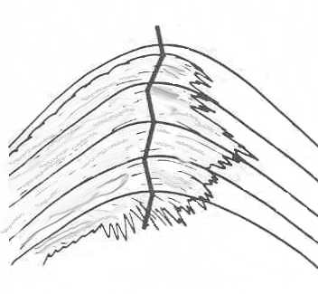
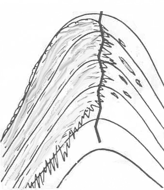
The location of mid-troposphere troughs and ridges in the midlatitude can be determined from analysis of the cloud patterns in infrared or visible imagery. Time sequences of images can indicate if a ridge is amplifying or breaking down.
Surface Press |
Cloud Pattern |
Notice how the high level clouds go beyond the ridge line. |
 |
With a high amplitude ridge the cloud pattern is steeper and ends closer to the ridge line. |
 |
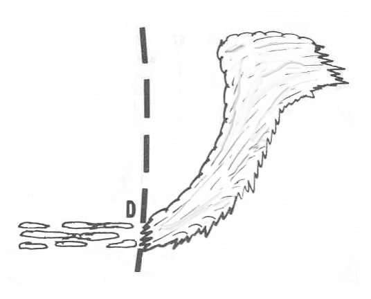
The troughline can be be found in frontal bands patterns as indicated in the adjacent figure. Notice the trough intersects the region where the frontal clouds become fragmented. |
 |
Return to Lesson 13
Return to Satellite Meteorology Main Page
AOS Main Page
Current Madison Weather
CIMSS GOES Gallery
|

