|
|
 |
08 October 2001 - Hurricane Iris
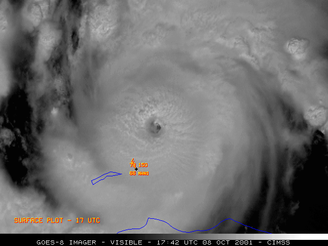
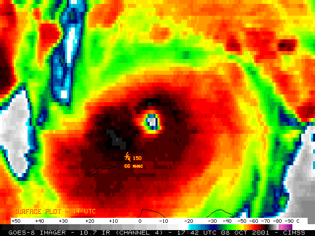
NOAA GOES-08 visible and InfraRed (IR) imagery (above) reveals the structure of the eye region of Hurricane Iris on 08 October 2001, as the storm was just off the coast of Honduras. The GOES-08 satellite was placed into Super Rapid Scan Operations (SRSO) mode, allowing imagery at 1-minute intervals during portions of the day.
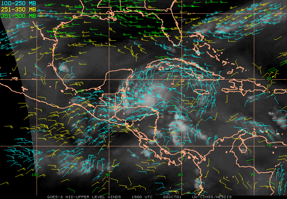
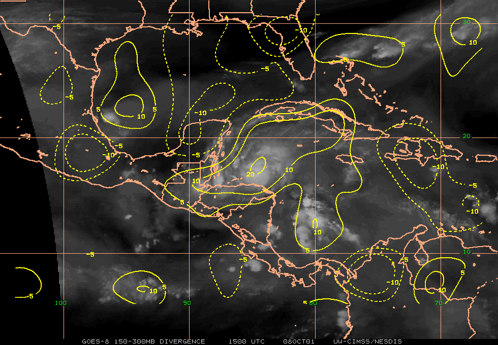
Hurricane Iris was undergoing a period of rapid intensification, reaching Category 4 strength with wind speeds estimated at 120 knots. In the IR animation above, colder cloud top temperatures could be seen filling in along the northern and eastern quadrants of the eyewall region. Upper level winds indicated that the hurricane was in an environment which exhibited strong upper level divergence, which is a favorable condition for continued intensification. Current satellite-derived winds products are available from the CIMSS Tropical Cyclones page.
Return to Lesson 12
Return to Satellite Meteorology Main Page
AOS Main Page
Current Madison Weather
CIMSS GOES Gallery
|


