|
|
 |
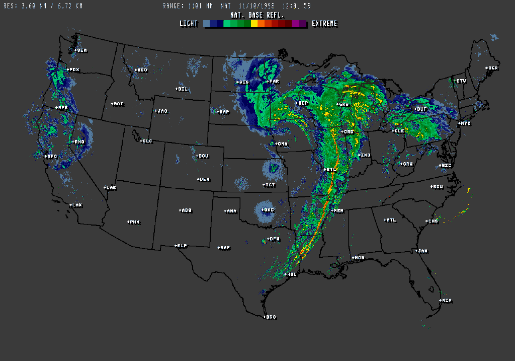
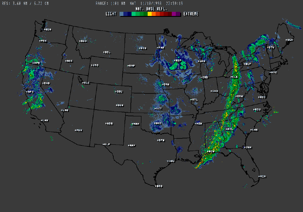
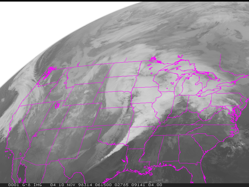
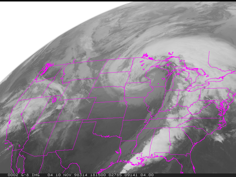
Radar and Thunderstorms
Objective
This lesson deals with how to interpret radar images, including the location of tornadoes, strong winds, and fronts.
Section 303 and 306 CASE STUDY Radar Images
Section 303 and 306 CASE STUDY Satellite Images
Return to Lab 101 Main Page
Local Madison Weather
|
