

Determining Atmospheric Winds using Satellite Observations
Professor Suomi pioneered the idea of using satellite observations of clouds to determine wind direction and speed. This alcove provides a conceptual explanation of how this is accomplished. Here's a link to some examples, in case you are interested in viewing some sample applications before a review of the approach.

The airplane above is traveling in a straight line at a constant speed. Its speed is the distance traveled divided by the time interval. If we know how far it is traveling in a given time we can determine its speed. We can calculate this speed if we have two images of the plane seperated in time.
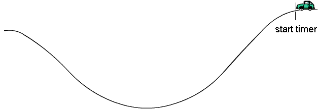
A timer is started when the following image of the plane is taken.

Two seconds later the next image was taken, after the plane traveled 400 meters. Thus, the airplane speed is 200 meters per second. Notice the distance is measured from the same spot on the plane, in this example from the nose.

In the above example the plane traveled in a straight line during the time we tracked it. What happens if the object we are tracking does not travel in a straight line? The average speed we calculate is incorrect. To visualize this consider tracking a car moving over a curved road. Again we start our clock when we take our first image.
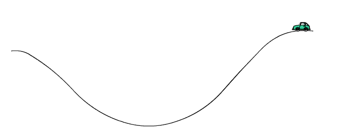
The second image is taken 15 minutes later. If the distance is measured from the front of the car in the first image to the front of the car in the second image, it travels a distance of 4 miles. Thus its apparent speed is 4/15 miles per minute or 16 miles per hour.

Of course the car did not travel in a straight line! To calculate the speed of the car we have to know the path the car traveled.
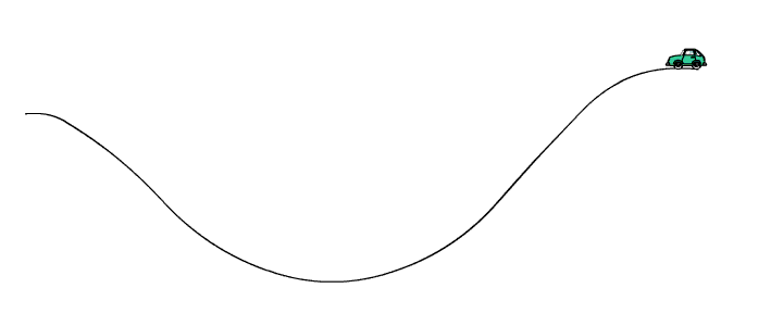
For a car this is easy, since a car typically drives along the road. So, we can calculate the distance the car traveled by measuring the length of the roadway between the two car images. The length of road the car traveled in 15 minutes is 8 miles, so the true average speed of the car is 8/15 miles per minute, or 32 miles per hour.
A problem we have in tracking clouds is that we do not know the path they take. In fact, if we can determine the path they take we can determine the wind direction. Watch the image of the car above and imagine that you did not have the roadway to help determine the cars path. A good way to determine the path of the car is to track two images of the car that are close in time.
In tracking clouds we do not have a road to help us determine there path. So we view two images of a cloud that are close in time. Time intervals of more than 15 minutes is not good for tracking clouds. Short time interval (1 to 5 minutes) are best. In track clouds we have additional problems besides not know the actual path.This is what is done using satellite images to track clouds. View the following animation of a cloud and determine what additional problems we encounter when tracking clouds to determine wind speed and direction.
Continue with tracking clouds using weather satellites.