

Determining Atmospheric Winds using Satellite Observations
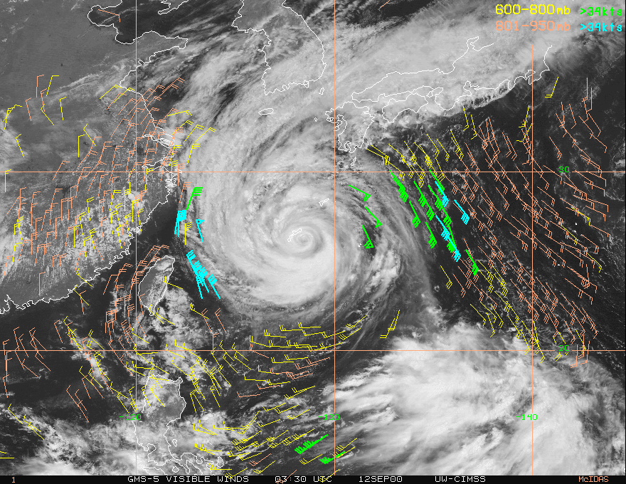
A time sequence of satellite images are routinely used to determine atmospheric wind speed by tracking the movements of winds. While the concept is simple, the proceedure is rather complex. Here's an example of cloud tracked winds around Typhoon Saomai from GMS-5 on 9/12/2000.
 Here is a link to cloud tracked winds for hurricanse in real-time (CIMSS hurricane page).
The following is an Java applet that allows you to experiment with deriving winds by tracking cloud features. The images are GOES visible images over the mid-west. In addition, current weather observations are also plotted. The two images are 1 hour apart. You can switch between them using the step button that appears below the image. The cross and X, are used to identify targets. The cross goest with the second, or later, image in the time sequence and the cross the first on. You can tell which scene you are on by the color of the cross, yellow indicates which target inditifier (cross or X) will be moved when you click the mouse button.
At the top of the image are listed three variables, the
time of the image, the Extrap will appear below in a Java enabled browser.
- Time: This give the time of the image you currently viewing.
- Bearing: This give the compise orientattion between the cross and X, and thus will give your wind direction.
- Distance: This give you the distance between the cross and X, and can be used to calculate wind speed (if you chose your targets correctly).
Continue with tracking clouds using weather satellites.