Background Material
28 December 1997 -- Severe Turbulence Over the West Pacific
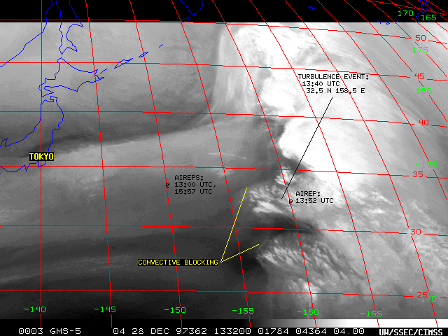
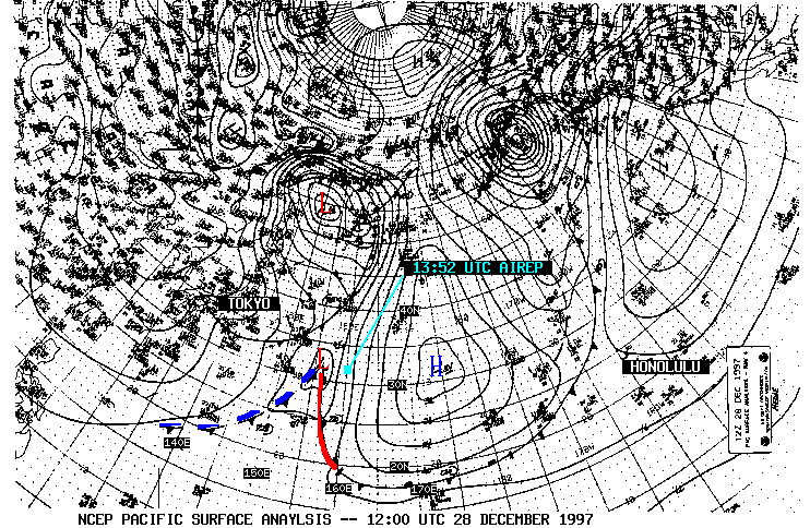
A United Airlines Boeing 747 encountered severe turbulence over the West Pacific Ocean while flying from Tokyo/Narita, Japan to Honolulu, Hawaii on 28 December 1997. Over 100 passengers were injured, and one fatality occurred. The event was attributed to clear air turbulence encountered at the cruising altitude of 9.5 km (31,000 ft), which caused a rapid 30-meter (100 ft) ascent followed 6 seconds later by a similar sharp descent.
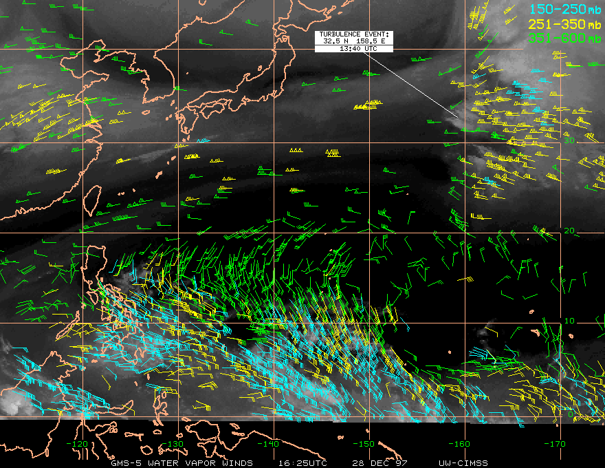
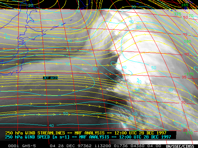
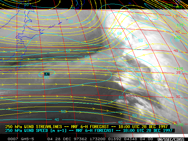
Japanese Geostationary Meteorological Satellite (GMS-5) 6.7 micron water vapor imagery, water vapor winds, and numerical model data indicated that a strong (70-80 m s-1 / 135-155 knot) jet streak was approaching the flight region between 12:00 UTC and 18:00 UTC. Thin cloud filaments could be seen propagating rapidly eastward along the jet streak axis near 35 N latitude. Several areas of convection had developed in the diffluent exit region east of this jet streak (generally east of 155-160 E longitude), with new convection forming south of 35 N latitude where low-level warm air advection was occurring in advance of an intensifying frontal wave.
Subtle, slow moving gravity-wave-like features were seen to form just upwind (along the NW edge) of the two clusters of convection located south of 35 N, indicating that the strong westerly winds associated with the jet streak were being "blocked" as the convection acted as a barrier to the flow (other types of blocking sometimes seen on water vapor imagery include the inside blocking boundary). It is possible that such high-altitude "convective blocking" may have contributed to clear air turbulence over the flight region. The banded nature of the convection (oriented NW-SE, parallel to the wind flow) also suggests that mesoscale instabilities (such as elevated convective instability, frontogenetical forcing, or conditional symmetric instability) may have been imbedded within the convective clusters located south of 35 N latitude.
Additional GMS imagery for this event can be found at CIMSS web page, thanks to Mr. Bachmeier
Return to Lesson 10 Page.
Return to Weather For Pilots Main Page
Local Madison Weather

