|
 |
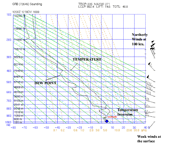
Mid-Latitude Cyclone PracticeHere's what the temperature and dewpoint vertical structure was on Nov 12, 1999 over Greenbay. Where the dewpoint and temperature are far apart is where the air is dry. When the dewpoint and tempreature get close together the air is moist, and when they are very close there is probably a cloud. So it is likely that a cloud exists around 800 mb. The blue ball represent a parcel of air near the ground that is rising. It starts off dry but reaches saturation (the relative humidity increases as the parcel cools as it expands), then it follows the moist adiabat. Notice the winds to the right. the winds are weak near the surface and increase with altitude, reaching about 100 kts near 250mb. Notice also that the winds are from the north (N) or NNW, so I would suspect that there is a ridge to the east of Greenbay! Finally, notice the temperature inversion - this is where the air is very stable.
Make sure there is the same temperature, dewpoint, windspeed and wind direction on the Stuve plot and the 850 mb map below.
Now its time for interactive practice!
Return to Return to case study lesson. Return to Lab 101 Main Page Local Madison Weather
|
 Compare the winds above, to those plotted on the 300 mb weather map. Is it consistent?
Where are the ridges and troughs on the 300 mb in relation to Greenbay?
Compare the winds above, to those plotted on the 300 mb weather map. Is it consistent?
Where are the ridges and troughs on the 300 mb in relation to Greenbay?
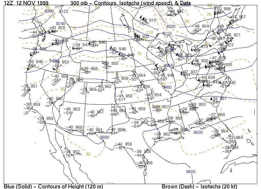
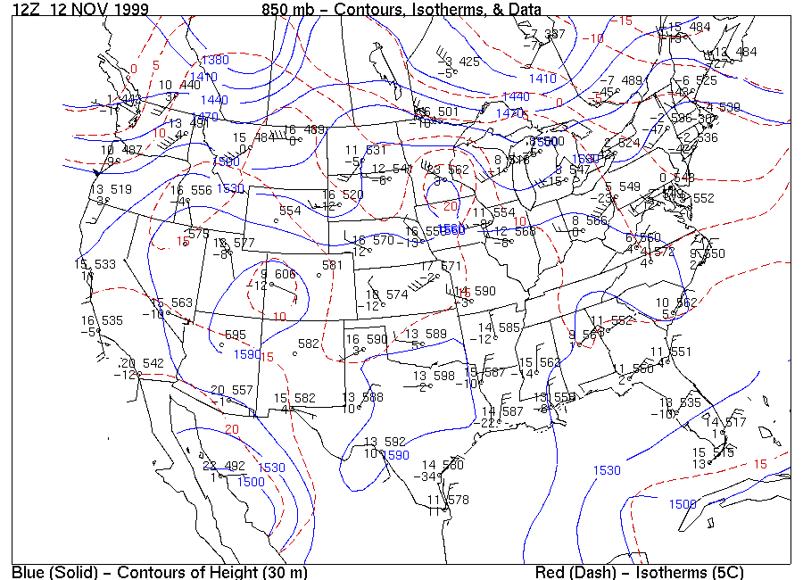 You should now have a good idea how these upper air maps are generated - we make weather observations from cities over the country twice a day, and use they observations to make our upper air maps, like the 300 mb and 850 mb.
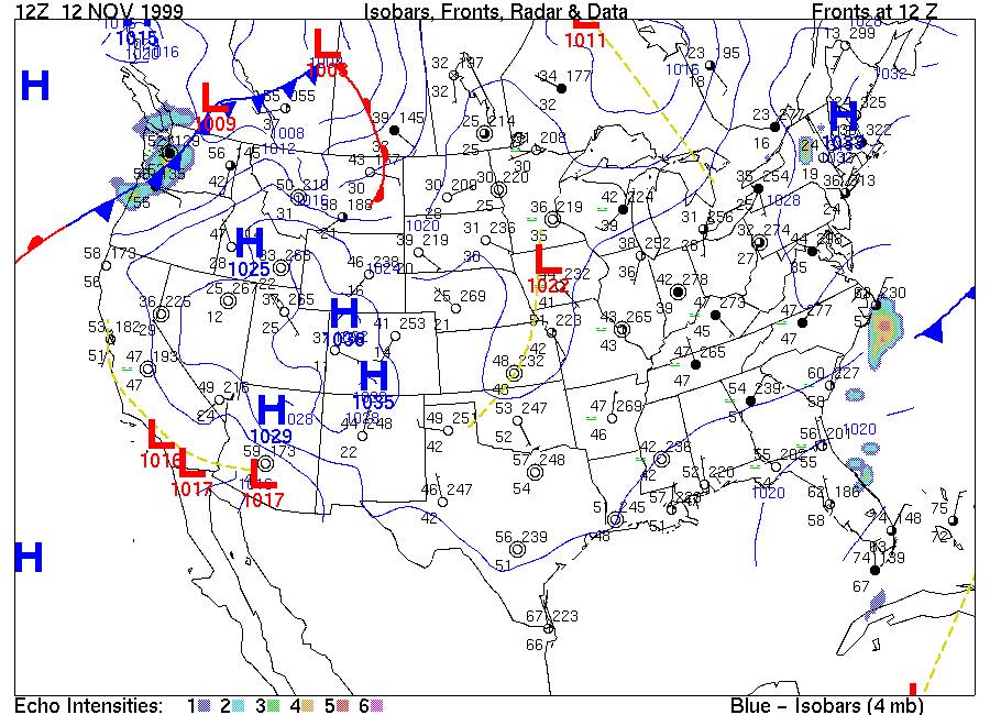
One final question - we made the observation that the Stuve diagram indicated a cloud around 800 mb. Notice, that the 850 mb map does not indicate that the temperature (8C) and dew point (-1C) are about 9 degrees apart, so the cloud is thin. How can we verify there is a cloud? Consider the surface map:
You should now have a good idea how these upper air maps are generated - we make weather observations from cities over the country twice a day, and use they observations to make our upper air maps, like the 300 mb and 850 mb.
One final question - we made the observation that the Stuve diagram indicated a cloud around 800 mb. Notice, that the 850 mb map does not indicate that the temperature (8C) and dew point (-1C) are about 9 degrees apart, so the cloud is thin. How can we verify there is a cloud? Consider the surface map: