Question 1
You call a friend, who lives 300 miles south of you. They say that
its 75°F with southerly winds and it
has just recently stopped raining. Youre in Madison where its
50°F and cloudy, with a light east
wind. It looks like its about to start raining. What kind of front is most likely between you and your friend? How do you know? What kinds of precipitation (and intensity) might you expect within the next several hours based on this front approaching you?
(Assume it is above freezing everywhere in the region.)
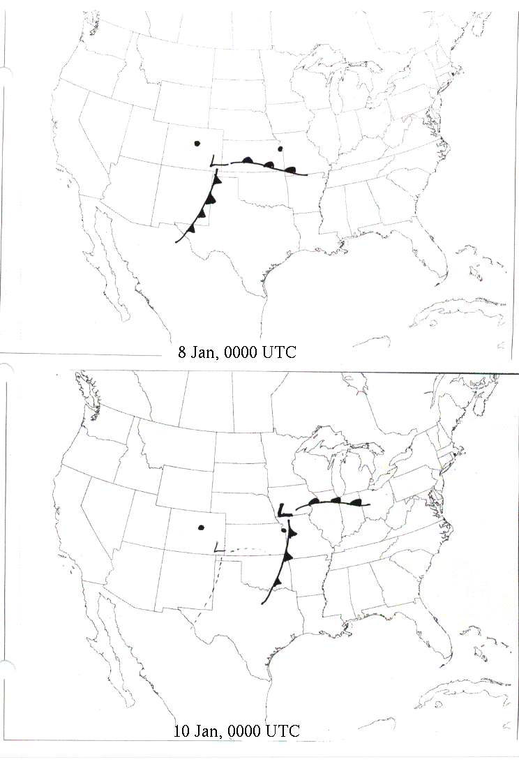
Question 2
Mid-Latitude cyclones move in time and space...
The following two maps show a mature winter mid-Latitude
cyclone at the beginning and end of a 24 hour period. Using your knowledge
of the weather associated fronts and the movement of midlatitude cyclones,
discuss how the temperature, wind direction,
precipitation and cloud cover will change over the 24 hour period at two cities,
Denver and Kansas City (marked on the map). Discuss the changes in weather
you would expect to occur at Denver and Kansas City between Jan 8 (top map)
and Jan 10 (bottom map - the dashed line represents the position of the front
on Jan 8). (It may help to think about each station one at a time and ask yourself
question such as: Did a warm front pass? Or a cold front? Or neither or both?
Then relate what you know about how precipitation, temperature and cloud cover
change as fronts and/or the low pass the station.)
|