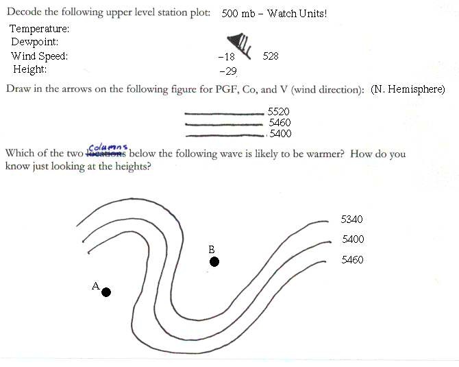
Lesson 1 Introduction
Lesson 2 Station Plotting-Decoding and Cloud Types
Lesson 3 Contouring I
Lesson 4 Contouring II
Lesson 5 Air Masses
Lesson 6 Fronts
Lesson 7 Satellite
Lesson 8 Radar
Lesson 9 Upper Air
Lesson 10 Case Study I
Lesson 11 Case Study II
Lesson 12 Case Study III

Upper Air

Assignment

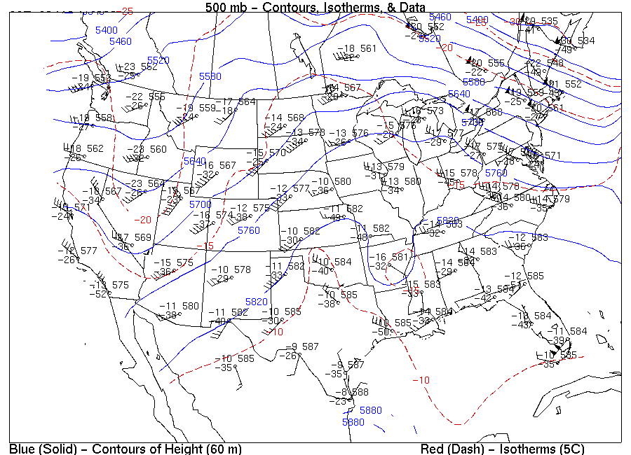
On the 500 mb map below denote regions you would might expect to find clear skies and other regions where you might expect to find clouds and even precipitation.

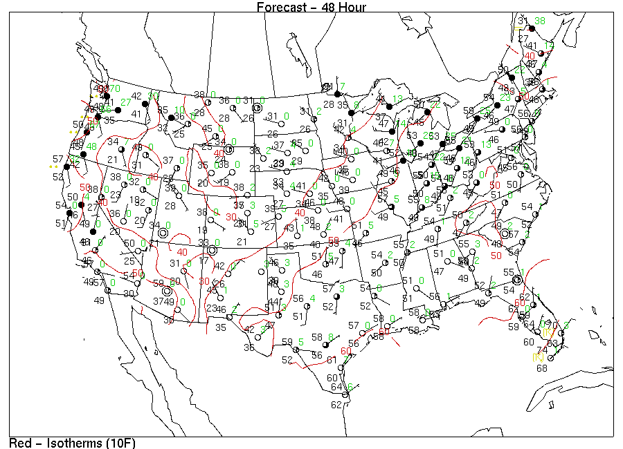
Below is a forecast for the weather on Nov 10. Draw where you would expect to find a ridge on an accompanying 500 mb map.

Return to Upper Air Lesson.

Return to Lab 101 Main Page

Local Madison Weather


This web based lab section is being developed with assistance from the College of Letters and Science and the Cooperative Institute of Meteorological Satellite Studies.   Material presented is Copyrighted (C) 1999 by Steve Ackerman .  Feel free to use this material for non-profit educational purposes!