Answer the following questions:
PART I
What is one big difference between GOES and Polar orbiter satellites?
DISCUSS a disadvantage of visible imagery. (i.e., explain it, don't just list it)
DISCUSS an advantage of infrared imagery. (As above)
PART II
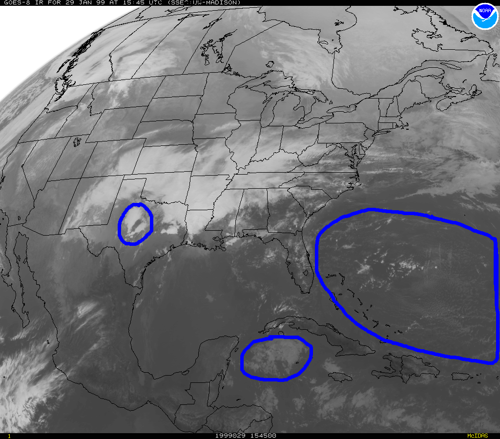
FOR THE IMAGES LINKED TO THIS PAGE (Do this part of the assignment while viewing the satellite images on the internet): Follow the example and use the same logic to decide what kind of cloud type is on the satellite images. GOES Visible Image and GOES Infrared Image
An example:
For the clouds just south of Cuba:
The visible tells me
That there is a batch of clouds there! They look like they are a mix of a layer of cumulus type cloud, probably stratocumulus, altocumulus or cirrocumulus.
The infrared tells me .
That these clouds are probably mid or low level, because they show up as a light grey.
So I think these are: Altocumulus.
Your turn:
For the clouds in central Texas
The visible tells me:
The infrared tells me:
So I think these are:
For the clouds in the Atlantic ocean: (The ones that cover a large area)
The visible tells me:
The infrared tells me:
So I think these are:
PART III
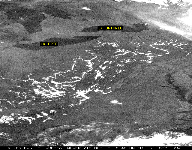
Describe what the major weather features you observe in this visible satellite image observed one early fall morning (of course tell me why you think this).
PART IV
This link allows you to switch views between a visible and infrared satellite image. Use this to identify the type of clouds that are located at the following locations marked on the image:A
B
C
D