Exercise:
Answer the following questionsPart 1, Questions
Describe a situation in which radar could overestimate precipitation.
(A sketch may be handy.)
Describe a situation in which radar could underestimate precipitation.
What is the main difference between conventional and doppler radar?
What is the main difference between a mesocyclone signature on a doppler radar screen and a tornado vortex signature (in terms of size)?
Explain how NEXRAD is more than just a doppler, and list some of the things it might help locate in a storm.
Part II, Images
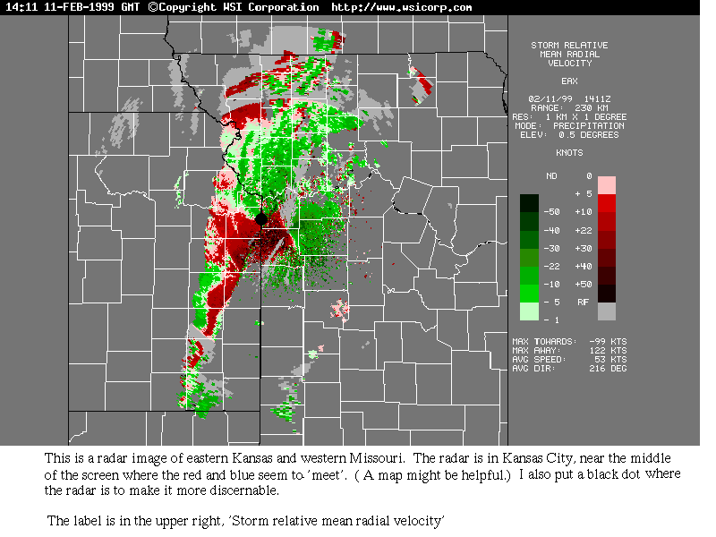
What is the label for this image?
Is this a conventional radar image or a Doppler image? (HINT: Look at the label)
So are you looking at a plot of precipitation intensity or wind direction and speed?
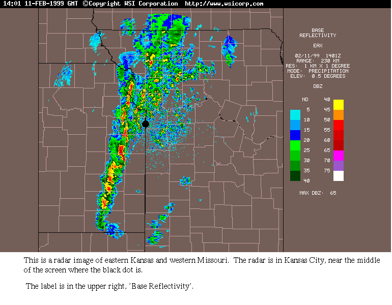
What is the label for this image?
Is this a conventional radar image or a doppler image? (HINT: Look at the label)
So are you looking at a plot of precipitation intensity or wind direction and speed?
LOOKING AT BOTH IMAGES decide the following:
In which region is it raining the heaviest? (You can use a state-type description, like 'north-central Texas' for example.)
According to the legend, what types of precipitation are on the reflectivity image?
What is the general wind direction (where is the wind coming FROM), shown by the doppler? (i.e., choose one direction, like northeast for example.)
Go to one of the websites I gave you, or find one on your own related to satellites or radar. Tell me about something new you learned from it. Don’t forget to tell me which one you chose!