The following maps depict the weather that occurred on Dec 12 and 13 1999. the maps are:
- 12Z Dec 12, 1999 Surface map,
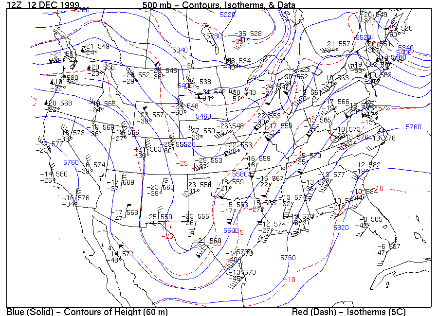
- 12 Z Dec 12 500 mb map,
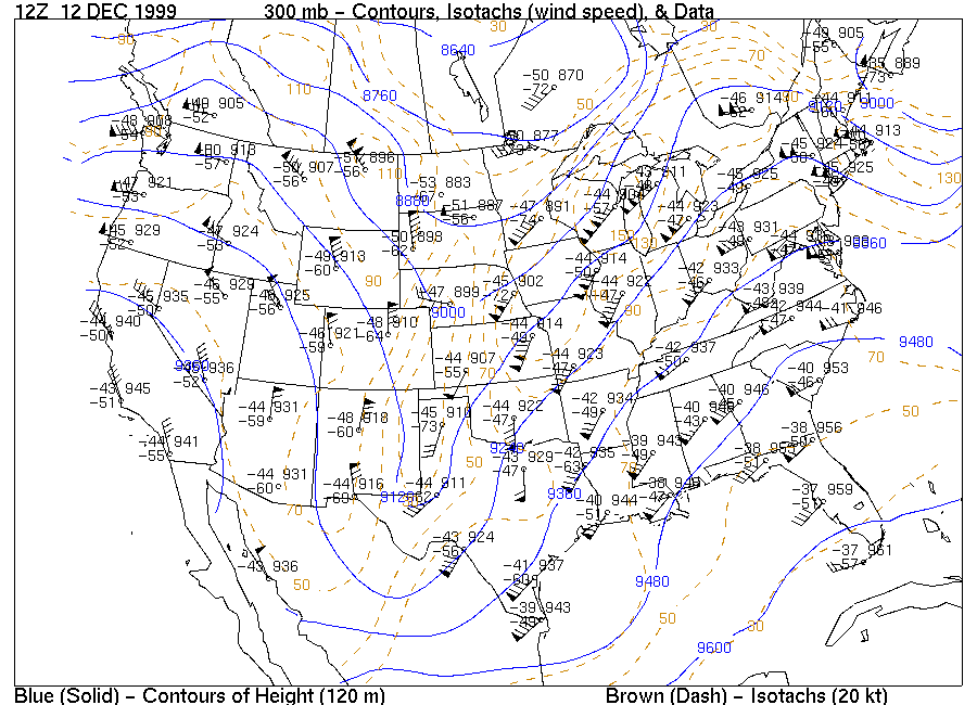
- 12Z Dec 12 300 mb map,
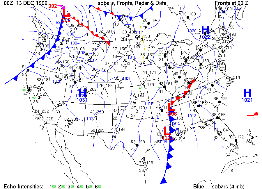
- 00Z Dec 13, 1999 Surface map,
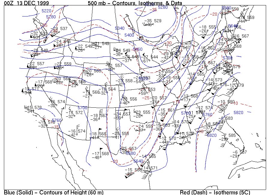
- 00Z Dec 13 500 mb map,
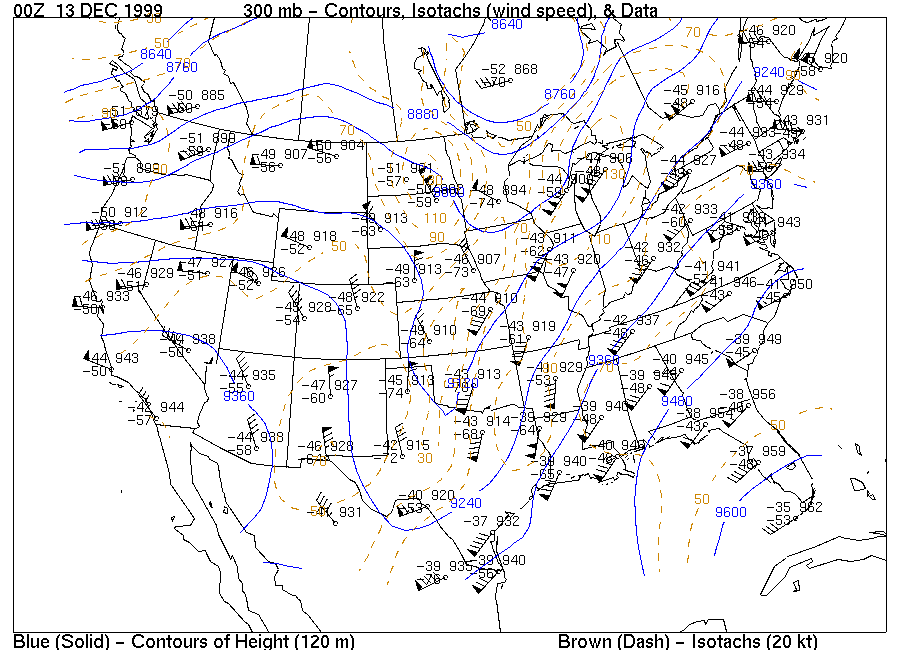
- 00Z Dec 13 300 mb map, and
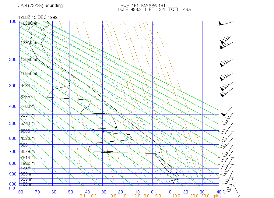
- 12Z Dec 12, Stuve diagram over Jackson Mississippi
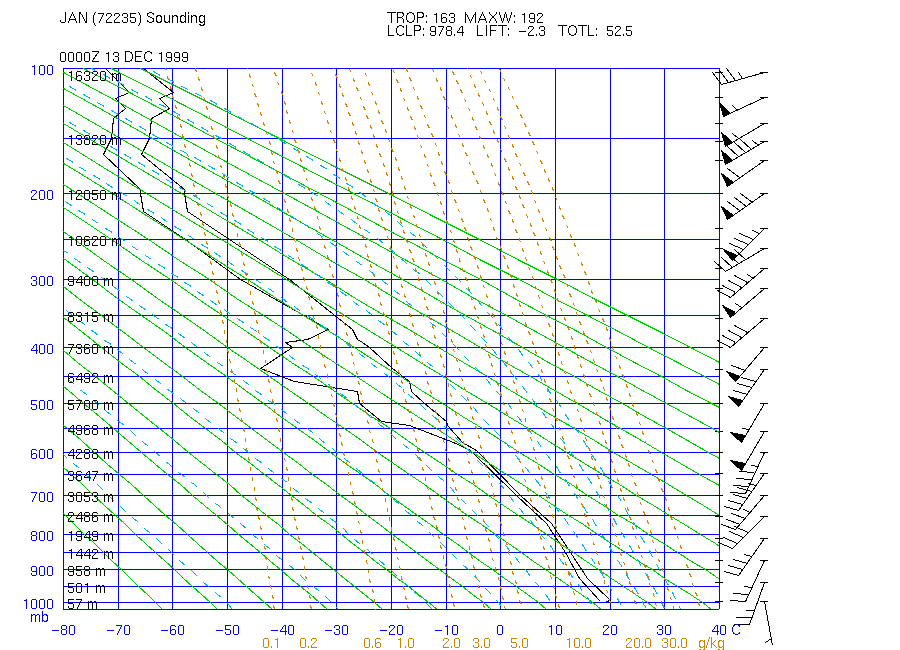
- 00Z Dec 13, Stuve diagram over Jackson Mississippi.
Using these maps answer the following questions:
- Describe the major weather features observed on 00Z Dec 13, 1999.
- What is the pressure level of the tropopause on 12Z Dec 12 over Jackson (also circle it on the diagram)?
- Circle, on the 00Z 13 December surface map, a region under the influence of a marime polar air mass.
- On 00Z Dec 13 there are no observations over Alabama. What would you say are the winds and cloud cover over Alabama? (Explain why you think this.)
- The weather radar was not available at this time. Circle the region of precipitation. What is (are) the lifting mechanism associated with this precipitation?
- How has the weather at the surface changed over Jackson over the last 12 hours? (the following applet may help you answer this question)