

Interpreting Satellite Visible and Infrared (IR) Images.
The good way to interpret satellite images is to view visible and infrared imagery together.
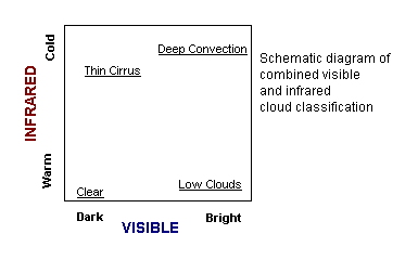
The following Java Applet allows you to morph between a satellite visible and infrared image so you can investigate the advantages of using the two observations together.