

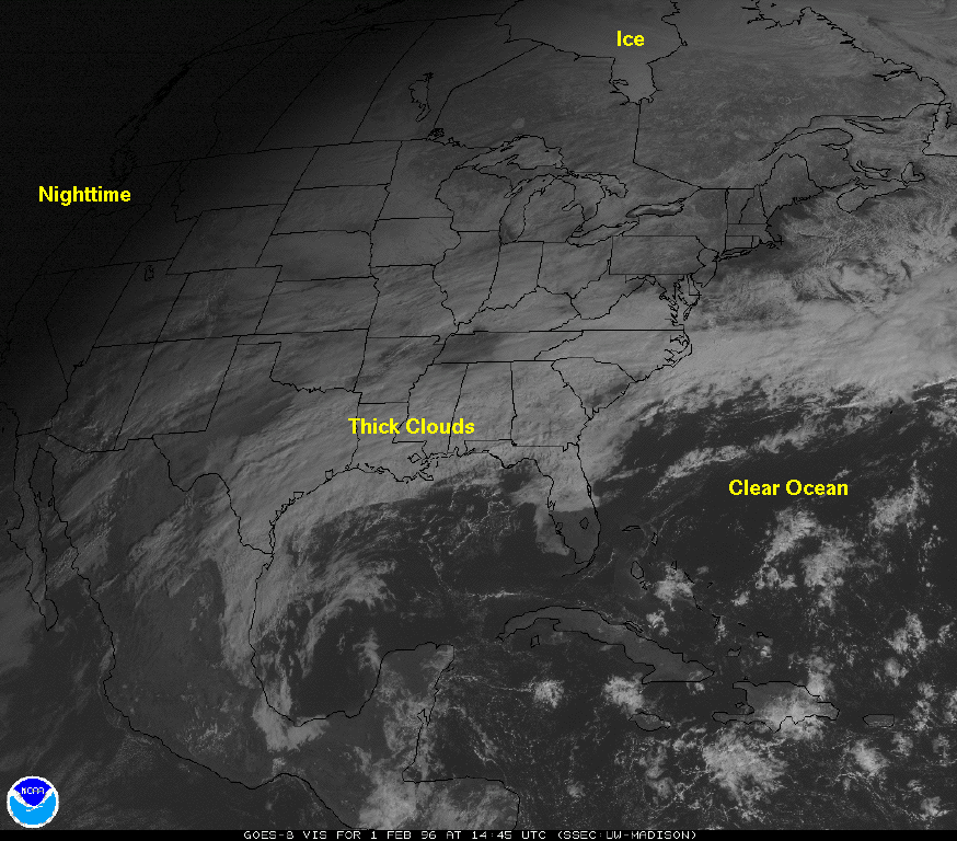
Interpreting Satellite Visible Images.
Dark areas in a visible image represent geographic regions were small amounts of visible light from the sun are reflected back to space. Whiter regions are objects that are highly reflective.
The oceans are usually dark while snow and thick clouds are bright.
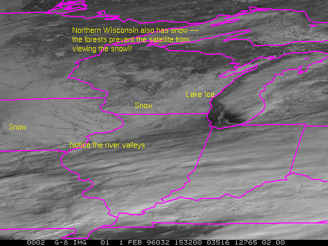
Don't be fooled by visible imagery.